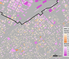
Introduction: The city of Shizuoka directly faces the Nankai Trough (known for its tsunamigenic history), and is facing a potential tsunami threat. In this setting vertical evacuation can be of great significance in reducing loss of life.
Methods: We apply a GIS based method in order to identify sites that could be utilized for vertical evacuation within the existing building stock of the city, under two tsunami scenarios of 5 and 10 meters of run-up. For each building, we estimate the volume that is expected to be lost per scenario, as well as the number of people inside and how that number fluctuates over different times of the day.
Results: Using the criteria of 25% or less building volume loss and 6 cubic meters of volume per person, resulted in 2,046 potential sites for the 10 meter scenario and 1,643 potential sites for the 5 meter scenario, with the maximum amount of people that can potentially be accepted in these sites in the morning hours being 873,537 in the 10 meter scenario and 304,734 in the 5 meter scenario.
Discussion: Our approach has shown that there is a temporal aspect in tsunami vertical evacuation due to the movement of the local population throughout the day. the proposed method can be used for preliminary identification of potential vertical evacuation sites, however, it must be followed by further vulnerability and engineering assessments of buildings, in combination with accessibility and evacuation routing in order to reach a viable and complete evacuation plan.
